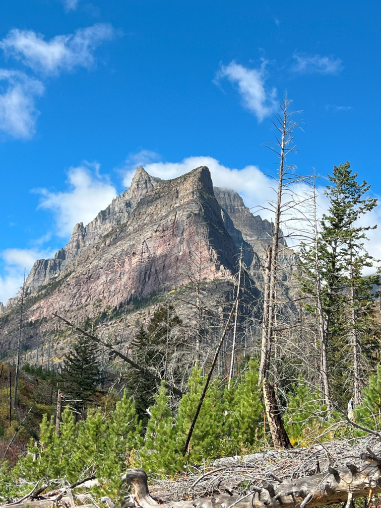
Glacier National Park consists of sedimentary rocks deposited in layers some 1.5 billion years ago. About 150 million years ago, plate tectonics pushed up and moved the sedimentary rocks forming a four-mile-thick slab of rock. About two million years ago, the climate cooled and enormous sheets of ice spread over North America. A cap of ice more than one mile thick covered the mountains and driven by gravity, carved the rock layers as it moved exposing the rock layers and carving the mountains we see today. The ice melted around 11,000 years ago leaving the spectacular landscape that we now enjoy.
The area was designated a National Park in 1910. North of the US border a Canadian Park, Waterton Lakes, was also created. Owing to the efforts of the Rotary Clubs of Alberta and Montana, the Waterton-Glacier International Peace Park was created as a symbol of the warm peaceful relations between the two nations. Built between 1921 and 1932, the Going-to-the Sun Road, a major engineering feat, was officially opened in 1933. Running from West to East across the park, through glaciated landscape, it provides roadside access to many of the most spectacular park features.
The road passes through two major tunnels, the eastern of which is shown below:

The sedimentary layers forming the mountains are readily apparent and two layers, in particular, are easy to trace. Red-rock layers were formed when iron-containing sediments were deposited in an oxygen-rich environment; here is an example:

Green rocks were formed when deposition occurred in an oxygen poor environment, causing the iron to bond with other compounds and creating the green mineral chlorite:

These layers can be seen in the feature below:

Here are some other nice examples:

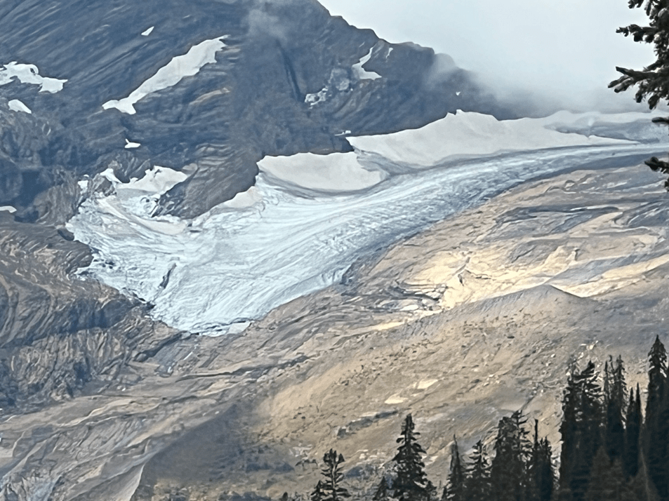
Some residual glaciers such as the Jackson Glacier (below) are still present but the glaciers are disappearing quickly and may be gone as early as 2030:
Nestled among the mountains are some lovely, glaciated valleys; this is a view from near “the Loop” portion of the Going-to-the-Sun road:

Rivers flow through the valleys, carving gorges, such as the Sun Rift Gorge:

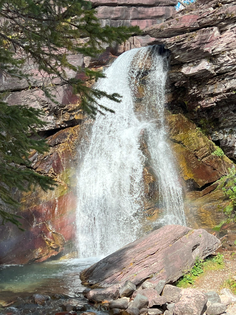
And cascading down waterfalls, such as the Baring Falls:
It is the dry season, so the 492 ft Bird Woman Falls is a little lacking in water:

However, there still seems to be plenty of rain from time to time:

The park sits on the crest of the Rocky Mountains and water drains into three major river systems: the Pacific via the Columbia, the Gulf of Mexico via the Mississippi/Missouri and to the Hudson Bay via the Saskatchewan/Nelson River.
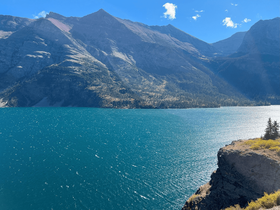
Amongst the most attractive features of the park are the deep glaciated lakes. Shown below is the Hidden Lake, which can be reached via a short hike from Logan Pass (the highest point on the Going-to-the-Sun Road):

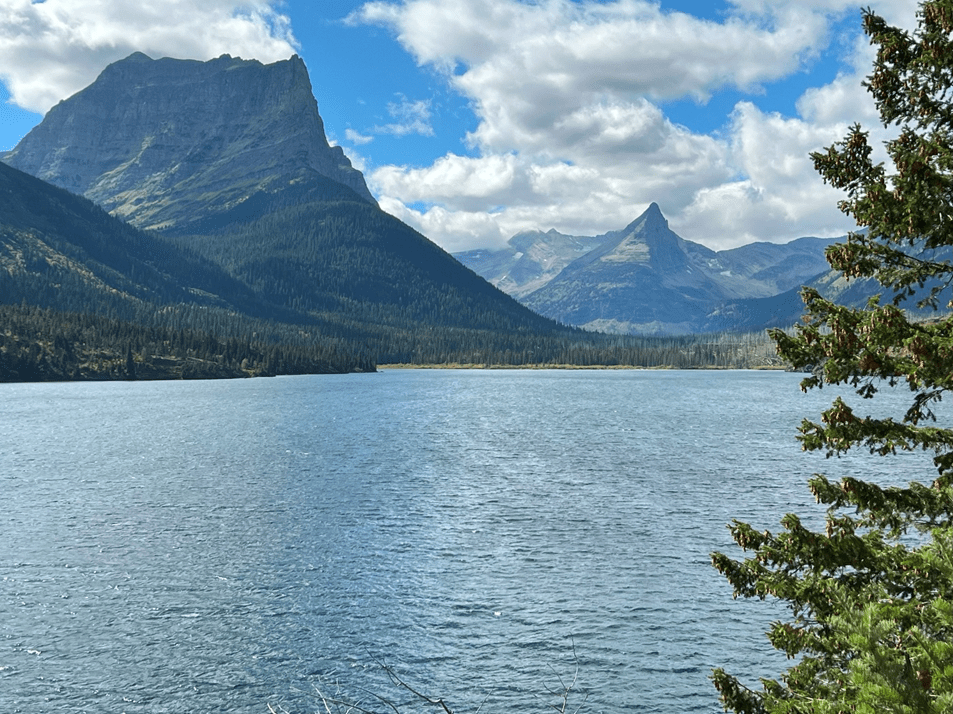
The two largest lakes are the McDonald in the west and St Mary in the east. The views of the lakes, surrounded by mountains are truly beautiful. My favorite spot in the Park is Sun Point overlooking St Mary Lake and I spent a few pleasant hour staring at these delightful views:

Time to leave this gorgeous place and head for the Theodore Roosevelt National Park.


Leave a comment